


Archivio Cot Alleghe
Before the formation of Lake Alleghe, the orography of the area presented a deep valley furrowed by the Cordevole torrent, which rose regularly from Avoscan to Caprile.
On the valley floor stood a few villages whose economy was based on the processing of iron from the Fursil mines, passing first through the smelting furnaces of Caprile where the raw ore was processed. These villages were positioned in such a way as to harness the power of the water to move the hammers and bellows of their workshops and allow the local craftsmen, masters in the working of swords, to produce not only fighting weapons but also cutlery and other finely crafted paraphernalia.
On the night between 10 and 11 January 1771, an enormous mass of rock, estimated at 10 million cubic metres, slid down from the summit of Monte Piz and shattered at the bottom of the valley, at the height of the present-day village of Masarè, sweeping away and destroying the villages of Riete, Fusine and Marin, 49 of whose inhabitants found no escape.
The landslide blocked the course of the torrent and quickly the waters began to rise up to 100 m high over what was the river bed, submerging other hamlets located further north. The inhabitants suddenly found themselves divided and isolated by the sheet of water that almost reached Caprile at its widest point. The village of Alleghe situated further upstream was saved from the flood; but that was not the end of it.
On the morning of the first of May, a second landslide measuring 3 million cubic metres broke away further to the north than the previous one and plunged into the very recent lake, raising a tsunami wave that reached Alleghe on the opposite bank, in the valley where the Zunaja torrent flows and seriously damaged the church, the rectory and the school of the Battuti, causing other victims.
Venice and Belluno, having been informed of the disaster, sent emissaries to deal with the difficulties faced by the population, the risk of submergence for the other villages and flooding for the villages to the south of the natural barrier, should the springtime swelling of the waters cause a breach in the barrier.
However, the cost of the works, the difficulty of reaching the site, and the unfavourable winter climate produced little result in the attempt to lower the water level, and a raft connection was built for the inhabitants to join the opposite banks.
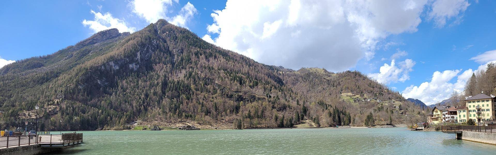
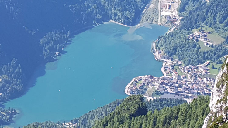
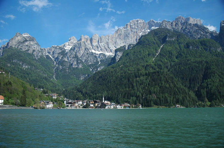
What remains today of this terrible tragedy is the marvellous lake where the town of Alleghe is mirrored and which, together with the vertical walls of the Civetta and the green undulations of the high altitude prairies, give rise to the typical Dolomite landscape, recognised as a UNESCO World Natural Heritage Site.
The exact time and date of the event has a fascinating history, well described by Giuseppe De Donà in the latest issue of the Alleghe parish bulletin, available in pdf (italian linguage)
In order to remember the formation of Lake Alleghe, Luisa Manfroi has collected the documents and testimonies of historians and has made this precious and important documentary that retraces the events of the night of 11 January 1771.